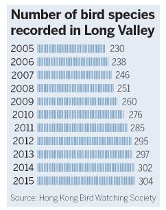
Wetland plan promotes more biodiversity


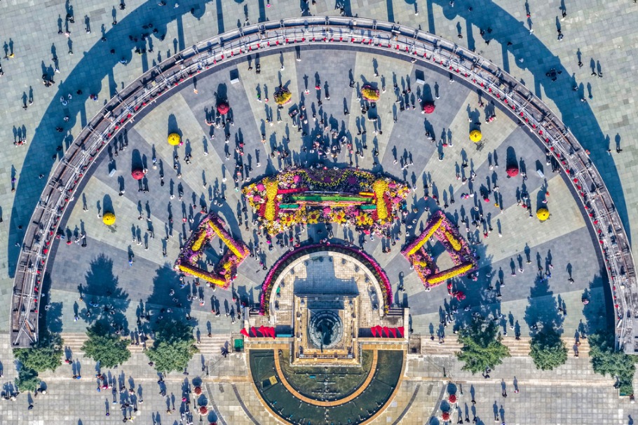
Seen from the air, the Beas River flows through Long Valley into a triangular gully, with villages located at all three points of the triangle. High-rise blocks dominate the skyline along to the border in Shenzhen, Guangdong province, and in the urban areas of Sheung Shui.
Since the Ming Dynasty (1368-1644), Long Valley, an area of streams, wet and dry vegetable fields, ponds, grasses, scrub and small areas of woodland, has been nourished and refreshed by an elaborate irrigation system, while the annual inundation produced a wide plain, creating the perfect habitat for wildlife.
In the 1990s, the annual flood washed away farmland and became a plague to farmers in the low-lying areas of the valley. In response, Hong Kong's Drainage Services Department devised a plan to straighten and channel the Beas River to stem the seasonal deluge. The move was successful and riverbanks were built up to handle even the most severe rainstorms that come only once every 200 years.


- 5 dead after entering abandoned mine in East China
- Andersson seizes victory in Shanghai F1H2O showdown
- Red alert as Typhoon Matmo makes landfall in South China
- New reception hall aims to transform Guangzhou into international trade hub
- Typhoon Matmo to make landfall on Sunday
- Mid-Autumn Festival event promotes cross-Strait harmony in Fuzhou